Krems Austria map: find your first stop
Locate the railway station, old-town gate, art district and river landing in one view.
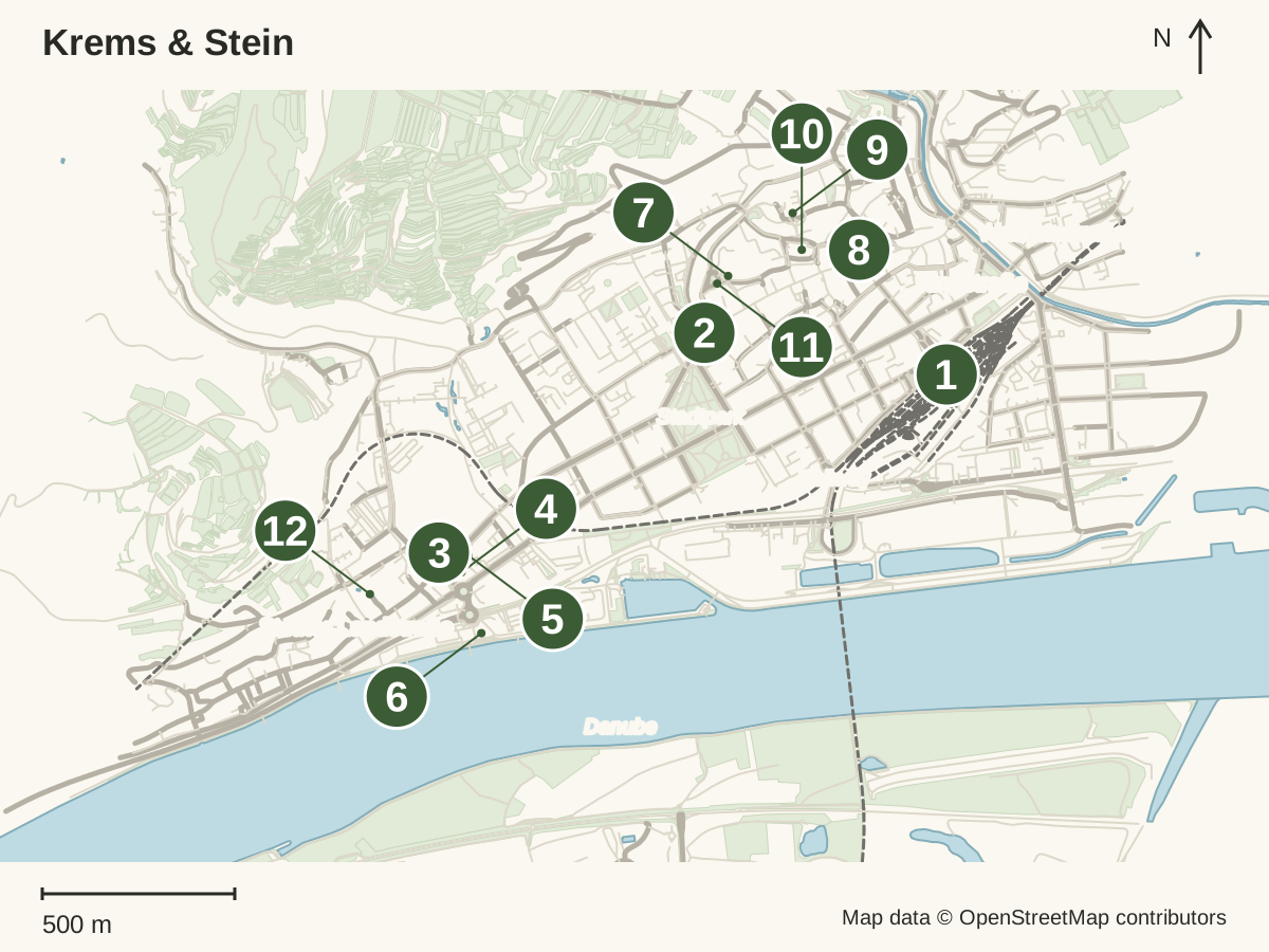
Orientation map, not turn-by-turn navigation. The stop filter changes the list below; the map always shows all twelve stops. Confirm your entrance or quay before leaving.
- Krems railway station
Rail arrival and departure point. Allow for the walk from your last town stop.
Open this location - Steiner Tor
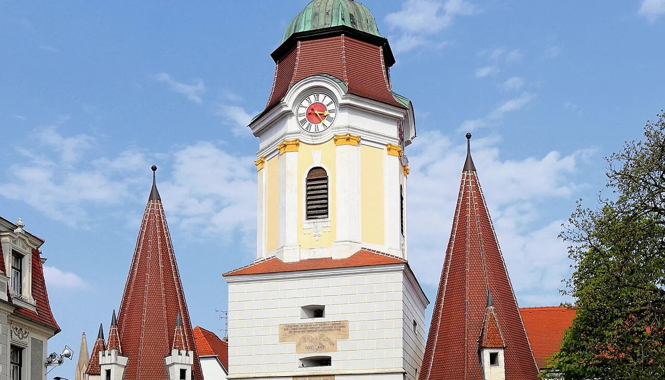
The surviving town gate and a useful landmark for the old streets.
Open this location - Kunsthalle Krems
An art venue in the Stein district; check the current exhibition.
Open this location - Landesgalerie Niederösterreich
The Lower Austria State Gallery in the art district.
Open this location - Karikaturmuseum
The caricature museum, near the other art venues.
Open this location - River landing area
River landing area in Stein. Your booking determines the actual quay.
Open this location - Museum Krems
Museum Krems, with its address at Körnermarkt 14 in the old town.
Open this location - Gozzoburg
A historic castle-palace in the old town; check current access.
Open this location - Piaristenkirche
A Catholic church in the old town, mapped at Frauenbergplatz; expect slopes and steps nearby.
Open this location - Pfarrkirche St. Veit
The Baroque Catholic parish church of St. Veit, a landmark in the old town.
Open this location - Körnermarkt
The street where Museum Krems has its address, a handy reference point in the old town.
Open this location - Forum Frohner
The Forum Frohner art venue at Minoritenplatz 4 in Stein, west of the main museum group.
Open this location
By Melk Abbey Last updated
This Krems Austria map puts the railway station, Steiner Tor, the art district in Stein, five old-town landmarks and the river landing in one view. The numbered points below the map stay readable on a phone and in print. Use it to choose your first stop and to understand the distance between the city centre and the river.
To compare a longer hike with a short town visit, use the official walking-stage comparison. Its route lengths are hiking distances, not direct transfers between the map points.
How to use the Krems Austria map
The station is the main anchor when arriving from Vienna. Steiner Tor helps you find the old streets, while the art venues sit farther towards Stein. A river departure may use a landing away from the station. Look at those points together before deciding how much you can see between trains.
The numbered legend identifies the same places as the map. Keep it open when the image is small on a phone. The map has a north arrow and scale so that distance and direction are clear. It does not draw an invented walking route or suggest that every road is suitable for every visitor.
OpenStreetMap is a contributed map. Mapped entrances and paths can change. A point on the map does not prove that a building is open. Follow signs on the ground. For a venue visit, use that venue's current details; for a departure, use the operator's planner.
Choose a starting point
For a short visit from the station, head towards the old-town area and Steiner Tor. Keep the return to the station within your plan. The Krems guide explains how the central streets and Stein differ, so you can choose one area without feeling you have missed a required circuit.
For an art day, make the museum district the main destination. Choose one venue's exhibition before adding another. Opening days and ticket plans can differ even when buildings are close together. Read the things-to-do guide for a town-and-art day with useful alternatives.
For a boat day, find the actual departure landing in your booking. A broad label such as Krems is not enough to identify the correct boarding point. Leave room for the walk from your last stop, and check the sailing direction. The return to Vienna may then start from a different town.
Map sources and limitations
The map uses geographically projected OpenStreetMap features retrieved on 21 October 2026. The street and river shapes come from mapped geometry; the numbered points come from mapped place coordinates. The legend and scale, plus orientation are part of the local image, so the map requires no third-party tiles or account.
Map data: OpenStreetMap contributors, under the Open Database Licence. The city context is checked against regional Krems and Stein visitor details.
Krems Austria map verdict
Use the Krems Austria map to place the station, old town and Stein before choosing your day. Keep the numbered legend with the image, and confirm the exact entrance or landing for a timed visit. For the rail leg, continue to the Vienna transport guide.